On Foot Holidays
A practical approach to walking holidays: On Foot Holidays’ navigation companion

Project team
Creating the perfect virtual tour guide for On Foot Holidays customers
On Foot Holidays operates within the niche travel and tourism sector, specifically focusing on self-guided walking holidays in rural Europe. This sector is characterised by a growing demand for authentic, immersive travel experiences that allow tourists to explore less commercialised, culturally rich destinations at their own pace. The company's primary business opportunity lies in catering to travellers who seek to discover unspoilt landscapes and local traditions without the interference of crowded tourist hotspots.
The specific business need that led to the project was the requirement for a more integrated and efficient navigation solution for self-guided walking tours. Previously, travellers had to rely on multiple sources for navigation, which often included carrying separate GPS devices or apps, and managing various printed materials such as maps and itineraries. This fragmented approach was cumbersome and detracted from the overall experience.
The project aimed to address these challenges by developing a bespoke app that would streamline the walking experience. The goal was to consolidate all necessary navigation tools, travel information, and route details into a single, easy-to-use digital platform. This approach aligns with broader industry trends towards digitalisation and environmental sustainability.
Prior to this project, existing solutions in the market were either too generic or required users to manage multiple applications, resulting in a less cohesive experience. By innovating in this space, On Foot Holidays sought to enhance the customer experience while also reducing the need for physical materials, ensuring that users receive the most current information and reducing the risk of navigating outdated or incorrect routes.
| Deliverables | Mobile App |
| Platforms | Android, IOS |
| Tech Stack | React Native, Leaflet.js, Crashlytics, Joomla |
| Sector | B2C, Hospitality & Travel |
Addressing challenges with comprehensive product consultancy
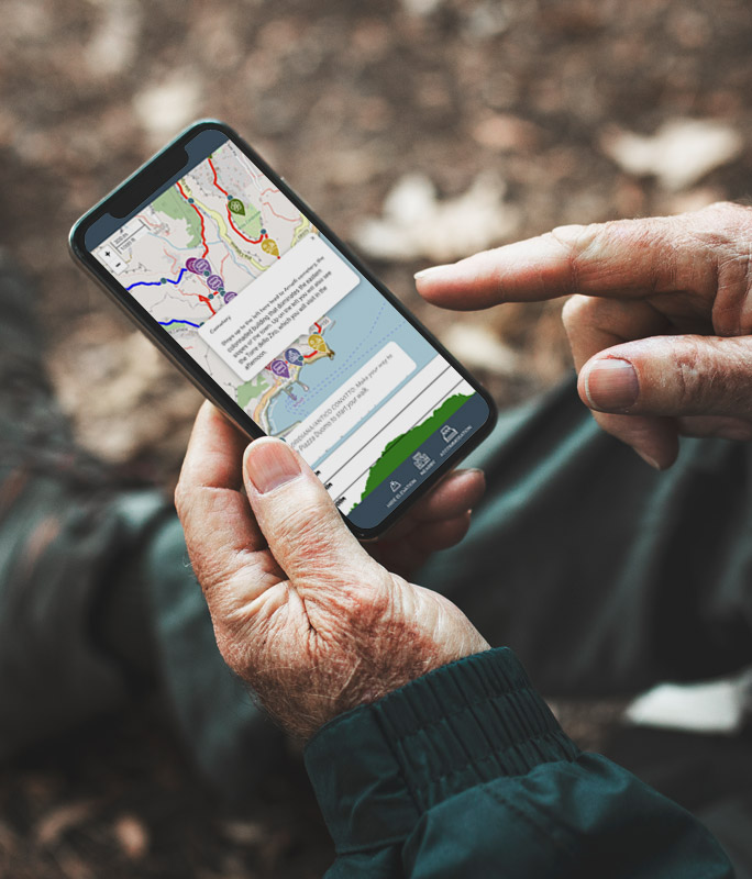
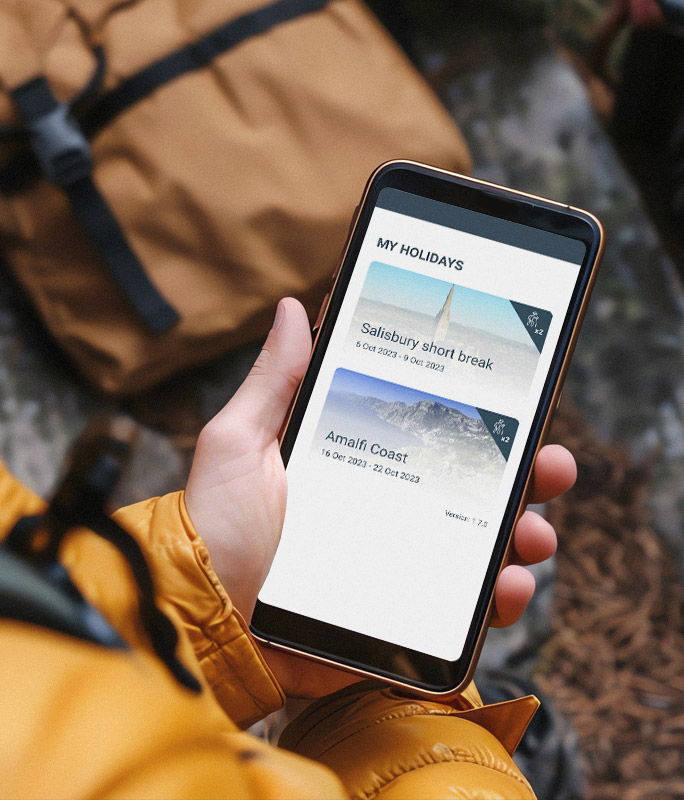
The project for On Foot Holidays aimed to develop a comprehensive mobile app that integrated GPS navigation, route tracking, and travel information into a single platform. The primary technical objectives included creating a user-friendly app capable of providing real-time navigation guidance, managing detailed itineraries, and delivering contextual information about the walking routes.
One significant uncertainty was whether it was feasible to integrate multiple map sources, such as Ordnance Survey maps, into a single app while ensuring seamless functionality and accuracy. This challenge arose because different map sources often use distinct data formats, scales, and updating mechanisms. The integration process needed to harmonise these differences to provide a unified and reliable mapping experience.
Developing a system for real-time location tracking and route alerts presented considerable uncertainties. The challenge was to ensure the app could provide accurate and timely notifications when users deviated from their planned route. This required addressing several technical issues, including optimising GPS accuracy in varied terrains and weather conditions, managing potential signal interference, and minimising battery consumption. Additionally, the system had to handle dynamic route changes and provide notifications with minimal delay to ensure users remained on track. Ensuring that the app's performance was consistent across different devices and operating systems added another layer of complexity.
Achieving reliable GPS tracking in diverse and sometimes challenging terrains was a primary concern. GPS signals can be affected by environmental factors such as dense foliage, mountainous regions, or urban canyons, leading to potential inaccuracies in location data. The challenge was to develop a robust system capable of maintaining accuracy and reliability across various scenarios, including low-signal environments and fluctuating weather conditions.
Creating a user-friendly interface that balances detailed information with ease of use required innovative design solutions. The app needed to display navigation aids, route details, and alerts without overwhelming users with excessive data. Designing an intuitive layout that facilitated quick comprehension and interaction, while ensuring that users received the necessary guidance, was critical. The interface had to accommodate users of varying technical proficiency and ensure that essential features were easily accessible.
To tackle the challenge of integrating diverse map sources, the team implemented a modular approach that enabled the dynamic incorporation of various map data through a centralised portal. Seamlessly converting different map formats and update mechanisms into a unified format, this approach ensured consistency and accuracy in map presentation while accommodating the unique requirements of each data source.
For real-time navigation and alerts, an adaptive system was implemented that utilised advanced tracking and averaging algorithms to provide accurate location tracking and timely route deviation notifications. This system was designed to optimise battery usage while maintaining high accuracy, addressing the challenge of GPS reliability and performance in varying conditions.

Cross-team collaboration to create a seamless user experience
The project began with an in-depth analysis of existing navigation technologies and user needs. The team identified key gaps in the market, such as the lack of solutions that combined multiple map sources and real-time navigation specific to self-guided walking tours. The team then focused on outlining the app’s core features: integrating diverse map sources, developing a reliable real-time navigation system, and ensuring both online and offline usability.
The first major challenge was the integration of diverse map sources, such as Ordnance Survey maps, into a unified platform. The team adopted a modular approach, allowing for the dynamic inclusion of various map formats. This required significant experimentation to determine how different data formats could be translated into a single, standardised format.
Several iterations were conducted to test the performance of the map integration. Initial tests showed incompatibility between certain map layers, leading the team to refine the data translation process. Advanced geospatial tools were employed, including Leaflet.js for map rendering and a WebView bridge for integrating into the React Native codebase. The app was then tested for its ability to update map data in real time while ensuring minimal lag or data discrepancies.
Next, the team tackled the uncertainty around real-time navigation and alerts. The goal was to create a system that could accurately track user location, provide timely notifications for route deviations, and function effectively even in areas with weak GPS signals.
To achieve this, an adaptive navigation system was developed, leveraging advanced location and averaging algorithms to enhance GPS accuracy and manage battery consumption. Early experiments revealed challenges in maintaining accuracy in remote areas with limited satellite visibility. The team conducted field tests in different terrains, including urban, rural, and mountainous regions, to collect data and refine the algorithms. Multiple iterations were necessary to balance the GPS precision with battery efficiency and performance. The final solution incorporated a hybrid method, combining GPS data with other sensor inputs from the user’s device to provide a more stable and accurate location tracking experience.
Simultaneously, the team worked on creating an intuitive user interface that balanced detailed route information with simplicity and ease of use. Prototype builds were developed, and client-led user testing sessions were conducted with a diverse group of potential users to gather feedback. These sessions identified key areas for improvement, such as the need for clearer visual cues and more accessible map controls and features. Based on the collected feedback, several iterations were developed and distributed, focusing on optimising the layout, data presentation and functionality of the solution. The team also designed a system to allow users to download map tiles for offline use, which was integrated into the app using React Native’s capabilities to store data locally. Further tests were conducted to ensure the interface remained responsive and user-friendly across different devices and operating systems.
Throughout the project, the team encountered numerous technical challenges, including managing data synchronisation between offline and online states, and ensuring that map updates were applied seamlessly. To address these uncertainties, the team ran controlled experiments to simulate various network conditions and assess the app’s performance. A significant challenge was ensuring that the app’s navigation and map data could be accessed and updated in real-time without draining device resources. The team explored different caching strategies and data compression techniques to optimise the data transfer and storage. These methods were iteratively tested and refined, leading to a solution that maintained high performance while conserving device battery life.
Successfully migrating to paperless through digital innovation
Our project for On Foot Holidays successfully developed an innovative cross-platform application that integrates GPS navigation, route tracking and comprehensive travel information into a single platform. This project addressed several significant technological uncertainties, including the integration of diverse map sources, ensuring real-time location accuracy, and delivering reliable navigation alerts across varied terrains. The team employed a modular approach to unify different map formats and developed an adaptive navigation system that balances high accuracy with performance and efficient battery use.
The successful creation of this app has marked a substantial advancement in On Foot Holidays’ service offerings, setting a new benchmark for self-guided walking tours. By overcoming challenges related to GPS reliability, data management and user interface design, the project has enabled the company to offer an innovative and seamless travel solution for its customers. This case study highlights the critical role of launching innovative technologies and enhancing user experiences, demonstrating a commitment to leading in the self-guided walking holiday sector.


